#> Simple feature collection with 2 features and 1 field
#> Geometry type: POINT
#> Dimension: XY
#> Bounding box: xmin: -3.816434 ymin: 48.59041 xmax: 5.038699 ymax: 51.53649
#> Geodetic CRS: WGS 84
#> # A tibble: 2 × 2
#> address geometry
#> * <chr> <POINT [°]>
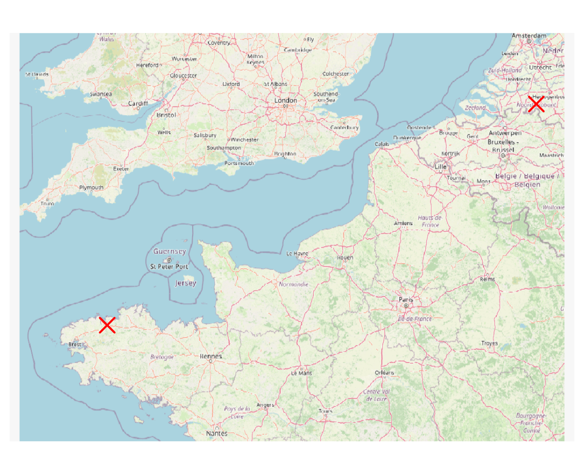
#> 1 10 Emma Goldmanweg, 5032MN Tilburg, Netherlands (5.038699 51.53649)
#> 2 19 rue Michel Bakounine, 29600 Morlaix, France (-3.816435 48.59041)
Pour créer un objet sf de type POINT à partir d’une paire de coordonnées, ici le point de longitude 0.5 et de latitude 45.5 en WGS84 (EPSG:4326), il est nécessaire de créer le data.frame au préalable :
#> Simple feature collection with 1 feature and 0 fields
#> Geometry type: POINT
#> Dimension:     XY
#> Bounding box:  xmin: 0.5 ymin: 45.5 xmax: 0.5 ymax: 45.5
#> Geodetic CRS:  WGS 84
#>           geometry
#> 1 POINT (0.5 45.5)
20.3 Affichage sur un fond OpenStreetMap
Nous pouvons afficher cet objet sf sur un fond de carte OpenStreetMap avec le package maptiles(Giraud, 2023).
library(mapsf)library(maptiles)# Récupération d'un fond de carte OSMosm <-get_tiles(x = place_sf, zoom =7)# Affichagemf_raster(osm)mf_map(place_sf, pch =4, cex =2, lwd =2, col ="red", add =TRUE)
Cambon, J., Hernangómez, D., Belanger, C. et Possenriede, D. (2021). tidygeocoder: An R package for geocoding. Journal of Open Source Software, 6(65), 3544. https://doi.org/10.21105/joss.03544